Beussent
Beussent | |
|---|---|
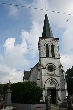 The church of Beussent | |
 Coat of arms | |
Location of Beussent | |
 Beussent  Beussent | |
| Coordinates: 50°32′50″N 1°47′35″E / 50.5472°N 1.7931°E / 50.5472; 1.7931 | |
| Country | France |
| Region | Hauts-de-France |
| Department | Pas-de-Calais |
| Arrondissement | Montreuil |
| Canton | Lumbres |
| Intercommunality | CC Haut Pays du Montreuillois |
| Government | |
| • Mayor (2020–2026) | Samuel Guerville[1] |
Area 1 | 15.93 km2 (6.15 sq mi) |
| Population (2022)[2] | 551 |
| • Density | 35/km2 (90/sq mi) |
| Time zone | UTC+01:00 (CET) |
| • Summer (DST) | UTC+02:00 (CEST) |
| INSEE/Postal code | 62123 /62170 |
| Elevation | 26–151 m (85–495 ft) (avg. 32 m or 105 ft) |
| 1 French Land Register data, which excludes lakes, ponds, glaciers > 1 km2 (0.386 sq mi or 247 acres) and river estuaries. | |
Beussent (French pronunciation: [bøsɑ̃]) is a commune in the Pas-de-Calais department in the Hauts-de-France region in northern France.[3]
Geography
A small village situated some 7 miles(11 km) north of Montreuil-sur-Mer, on the D127 road.
Population
| Year | Pop. | ±% p.a. |
|---|---|---|
| 1968 | 455 | — |
| 1975 | 421 | −1.10% |
| 1982 | 413 | −0.27% |
| 1990 | 450 | +1.08% |
| 1999 | 411 | −1.00% |
| 2009 | 500 | +1.98% |
| 2014 | 547 | +1.81% |
| 2020 | 537 | −0.31% |
| Source: INSEE[4] | ||
See also
References
- ^ "Répertoire national des élus: les maires". data.gouv.fr, Plateforme ouverte des données publiques françaises (in French). 9 August 2021.
- ^ "Populations de référence 2022" (in French). The National Institute of Statistics and Economic Studies. 19 December 2024.
- ^ INSEE commune file
- ^ Population en historique depuis 1968, INSEE
Wikimedia Commons has media related to Beussent.
This article is issued from Wikipedia. The text is available under Creative Commons Attribution-Share Alike 4.0 unless otherwise noted. Additional terms may apply for the media files.