Essars
Essars | |
|---|---|
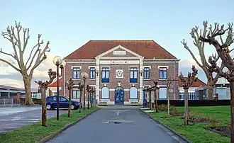 The town hall of Essars | |
 Coat of arms | |
Location of Essars | |
 Essars  Essars | |
| Coordinates: 50°32′52″N 2°39′55″E / 50.5478°N 2.6653°E / 50.5478; 2.6653 | |
| Country | France |
| Region | Hauts-de-France |
| Department | Pas-de-Calais |
| Arrondissement | Béthune |
| Canton | Beuvry |
| Intercommunality | CA Béthune-Bruay, Artois-Lys Romane |
| Government | |
| • Mayor (2020–2026) | Gérard Malbranque[1] |
Area 1 | 3.72 km2 (1.44 sq mi) |
| Population (2022)[2] | 1,765 |
| • Density | 470/km2 (1,200/sq mi) |
| Time zone | UTC+01:00 (CET) |
| • Summer (DST) | UTC+02:00 (CEST) |
| INSEE/Postal code | 62310 /62400 |
| Elevation | 18–23 m (59–75 ft) (avg. 21 m or 69 ft) |
| 1 French Land Register data, which excludes lakes, ponds, glaciers > 1 km2 (0.386 sq mi or 247 acres) and river estuaries. | |
Essars (French pronunciation: [esaʁ]) is a commune in the Pas-de-Calais department in the Hauts-de-France region of France[3] northeast of Béthune and 20 miles (32 km) southwest of Lille.
Population
| Year | Pop. | ±% p.a. |
|---|---|---|
| 1968 | 1,175 | — |
| 1975 | 1,151 | −0.29% |
| 1982 | 1,683 | +5.58% |
| 1990 | 1,919 | +1.65% |
| 1999 | 1,732 | −1.13% |
| 2007 | 1,645 | −0.64% |
| 2012 | 1,615 | −0.37% |
| 2017 | 1,725 | +1.33% |
| Source: INSEE[4] | ||
See also
References
- ^ "Répertoire national des élus: les maires". data.gouv.fr, Plateforme ouverte des données publiques françaises (in French). 2 December 2020.
- ^ "Populations de référence 2022" (in French). The National Institute of Statistics and Economic Studies. 19 December 2024.
- ^ INSEE commune file
- ^ Population en historique depuis 1968, INSEE
Wikimedia Commons has media related to Essars.
This article is issued from Wikipedia. The text is available under Creative Commons Attribution-Share Alike 4.0 unless otherwise noted. Additional terms may apply for the media files.