Caucourt
Caucourt | |
|---|---|
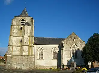 The church of Caucourt | |
 Coat of arms | |
Location of Caucourt | |
 Caucourt  Caucourt | |
| Coordinates: 50°23′58″N 2°34′20″E / 50.3994°N 2.5722°E / 50.3994; 2.5722 | |
| Country | France |
| Region | Hauts-de-France |
| Department | Pas-de-Calais |
| Arrondissement | Béthune |
| Canton | Bruay-la-Buissière |
| Intercommunality | CA Béthune-Bruay, Artois-Lys Romane |
| Government | |
| • Mayor (2020–2026) | Danièle Philippe[1] |
Area 1 | 5.51 km2 (2.13 sq mi) |
| Population (2022)[2] | 332 |
| • Density | 60/km2 (160/sq mi) |
| Time zone | UTC+01:00 (CET) |
| • Summer (DST) | UTC+02:00 (CEST) |
| INSEE/Postal code | 62218 /62150 |
| Elevation | 94–157 m (308–515 ft) (avg. 112 m or 367 ft) |
| 1 French Land Register data, which excludes lakes, ponds, glaciers > 1 km2 (0.386 sq mi or 247 acres) and river estuaries. | |
Caucourt (French pronunciation: [kokuʁ]) is a commune in the Pas-de-Calais department in the Hauts-de-France region of France[3] about 10 miles (16 km) northwest of Arras. The Blanch stream rises there, forming the source of the Lawe river.
Population
| Year | Pop. | ±% p.a. |
|---|---|---|
| 1968 | 283 | — |
| 1975 | 268 | −0.77% |
| 1982 | 275 | +0.37% |
| 1990 | 270 | −0.23% |
| 1999 | 277 | +0.28% |
| 2007 | 315 | +1.62% |
| 2012 | 337 | +1.36% |
| 2017 | 346 | +0.53% |
| Source: INSEE[4] | ||
See also
References
- ^ "Répertoire national des élus: les maires". data.gouv.fr, Plateforme ouverte des données publiques françaises (in French). 9 August 2021.
- ^ "Populations de référence 2022" (in French). The National Institute of Statistics and Economic Studies. 19 December 2024.
- ^ INSEE commune file
- ^ Population en historique depuis 1968, INSEE
External links
Wikimedia Commons has media related to Caucourt.
- Official municipality website (in French)
This article is issued from Wikipedia. The text is available under Creative Commons Attribution-Share Alike 4.0 unless otherwise noted. Additional terms may apply for the media files.