Siracourt
Siracourt | |
|---|---|
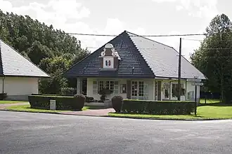 The town hall and school of Siracourt | |
 Coat of arms | |
Location of Siracourt | |
 Siracourt  Siracourt | |
| Coordinates: 50°22′24″N 2°16′18″E / 50.3733°N 2.2717°E | |
| Country | France |
| Region | Hauts-de-France |
| Department | Pas-de-Calais |
| Arrondissement | Arras |
| Canton | Saint-Pol-sur-Ternoise |
| Intercommunality | CC Ternois |
| Government | |
| • Mayor (2020–2026) | André Genelle[1] |
Area 1 | 3.14 km2 (1.21 sq mi) |
| Population (2022)[2] | 282 |
| • Density | 90/km2 (230/sq mi) |
| Time zone | UTC+01:00 (CET) |
| • Summer (DST) | UTC+02:00 (CEST) |
| INSEE/Postal code | 62797 /62130 |
| Elevation | 124–154 m (407–505 ft) |
| 1 French Land Register data, which excludes lakes, ponds, glaciers > 1 km2 (0.386 sq mi or 247 acres) and river estuaries. | |
Siracourt (French pronunciation: [siʁakuʁ]) is a commune in the Pas-de-Calais department in the Hauts-de-France region of France.[3]
Geography
Siracourt lies 27 miles (43 km) west of Arras and 3 miles (5 km) west of Saint-Pol-sur-Ternoise, near the junction of the D100 and N39 roads.
Population
| Year | Pop. | ±% p.a. |
|---|---|---|
| 1968 | 158 | — |
| 1975 | 163 | +0.45% |
| 1982 | 140 | −2.15% |
| 1990 | 223 | +5.99% |
| 1999 | 228 | +0.25% |
| 2007 | 240 | +0.64% |
| 2012 | 257 | +1.38% |
| 2017 | 269 | +0.92% |
| Source: INSEE[4] | ||
Places of interest
- The modern church of St. Germain, rebuilt, along with the entire village after World War II.
- The Siracourt V-1 bunker, built during World War II.
See also
References
- ^ "Répertoire national des élus: les maires". data.gouv.fr, Plateforme ouverte des données publiques françaises (in French). 9 August 2021.
- ^ "Populations de référence 2022" (in French). The National Institute of Statistics and Economic Studies. 19 December 2024.
- ^ INSEE commune file
- ^ Population en historique depuis 1968, INSEE
Wikimedia Commons has media related to Siracourt.