Linzeux
Linzeux | |
|---|---|
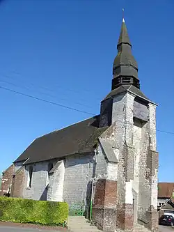 The church of Linzeux | |
 Coat of arms | |
Location of Linzeux | |
 Linzeux  Linzeux | |
| Coordinates: 50°20′32″N 2°12′20″E / 50.3422°N 2.2056°E / 50.3422; 2.2056 | |
| Country | France |
| Region | Hauts-de-France |
| Department | Pas-de-Calais |
| Arrondissement | Arras |
| Canton | Saint-Pol-sur-Ternoise |
| Intercommunality | CC Ternois |
| Government | |
| • Mayor (2020–2026) | Jean-Noël Fourdinier[1] |
Area 1 | 4.71 km2 (1.82 sq mi) |
| Population (2022)[2] | 172 |
| • Density | 37/km2 (95/sq mi) |
| Time zone | UTC+01:00 (CET) |
| • Summer (DST) | UTC+02:00 (CEST) |
| INSEE/Postal code | 62518 /62270 |
| Elevation | 63–121 m (207–397 ft) (avg. 100 m or 330 ft) |
| 1 French Land Register data, which excludes lakes, ponds, glaciers > 1 km2 (0.386 sq mi or 247 acres) and river estuaries. | |
Linzeux (French pronunciation: [lɛ̃zø]) is a commune in the Pas-de-Calais department in the Hauts-de-France region of France.[3]
Geography
Linzeux is situated 26 miles (42 km) west of Arras, at the junction of the D101 and the D109 roads.
Population
| Year | Pop. | ±% p.a. |
|---|---|---|
| 1968 | 193 | — |
| 1975 | 177 | −1.23% |
| 1982 | 157 | −1.70% |
| 1990 | 150 | −0.57% |
| 1999 | 148 | −0.15% |
| 2007 | 148 | +0.00% |
| 2012 | 170 | +2.81% |
| 2017 | 153 | −2.09% |
| Source: INSEE[4] | ||
Places of interest
- The church of Notre-Dame, dating from the eighteenth century.
See also
References
- ^ "Répertoire national des élus: les maires". data.gouv.fr, Plateforme ouverte des données publiques françaises (in French). 9 August 2021.
- ^ "Populations de référence 2022" (in French). The National Institute of Statistics and Economic Studies. 19 December 2024.
- ^ INSEE commune file
- ^ Population en historique depuis 1968, INSEE
Wikimedia Commons has media related to Linzeux.
This article is issued from Wikipedia. The text is available under Creative Commons Attribution-Share Alike 4.0 unless otherwise noted. Additional terms may apply for the media files.