Montigny-en-Gohelle
Montigny-en-Gohelle | |
|---|---|
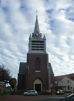 The church of Montigny-en-Gohelle | |
 Coat of arms | |
Location of Montigny-en-Gohelle | |
 Montigny-en-Gohelle  Montigny-en-Gohelle | |
| Coordinates: 50°25′43″N 2°55′51″E / 50.4286°N 2.9308°E | |
| Country | France |
| Region | Hauts-de-France |
| Department | Pas-de-Calais |
| Arrondissement | Lens |
| Canton | Hénin-Beaumont-1 |
| Intercommunality | CA Hénin-Carvin |
| Government | |
| • Mayor (2020–2026) | Marcello Della Franca[1] |
Area 1 | 3.5 km2 (1.4 sq mi) |
| Population (2022)[2] | 9,667 |
| • Density | 2,800/km2 (7,200/sq mi) |
| Time zone | UTC+01:00 (CET) |
| • Summer (DST) | UTC+02:00 (CEST) |
| INSEE/Postal code | 62587 /62640 |
| Elevation | 23–42 m (75–138 ft) |
| 1 French Land Register data, which excludes lakes, ponds, glaciers > 1 km2 (0.386 sq mi or 247 acres) and river estuaries. | |
Montigny-en-Gohelle (French pronunciation: [mɔ̃tiɲi ɑ̃ ɡɔɛl], lit. 'Montigny in Gohelle') is a commune in the Pas-de-Calais department in the Hauts-de-France region of France[3] 7 miles (11 km) east of Lens.
Population
| Year | Pop. | ±% p.a. |
|---|---|---|
| 1968 | 8,908 | — |
| 1975 | 9,232 | +0.51% |
| 1982 | 11,140 | +2.72% |
| 1990 | 10,629 | −0.59% |
| 1999 | 10,558 | −0.07% |
| 2007 | 10,338 | −0.26% |
| 2012 | 10,326 | −0.02% |
| 2017 | 10,198 | −0.25% |
| Source: INSEE[4] | ||
Twin Towns
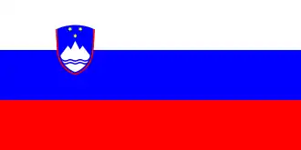 Hrastnik
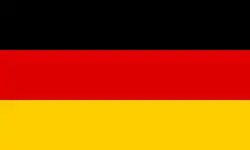 Stollberg
- Johannesburg
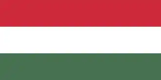 Tamási
 Ruda Śląska
See also
References
- ^ "Répertoire national des élus: les maires". data.gouv.fr, Plateforme ouverte des données publiques françaises (in French). 9 August 2021.
- ^ "Populations de référence 2022" (in French). The National Institute of Statistics and Economic Studies. 19 December 2024.
- ^ INSEE commune file
- ^ Population en historique depuis 1968, INSEE
External links
Wikimedia Commons has media related to Montigny-en-Gohelle.