Mingoval
Mingoval | |
|---|---|
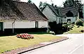
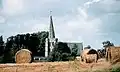 The church of Mingoval | |
 Coat of arms | |
Location of Mingoval | |
 Mingoval  Mingoval | |
| Coordinates: 50°22′31″N 2°34′32″E / 50.3753°N 2.5756°E / 50.3753; 2.5756 | |
| Country | France |
| Region | Hauts-de-France |
| Department | Pas-de-Calais |
| Arrondissement | Arras |
| Canton | Avesnes-le-Comte |
| Intercommunality | CC Campagnes de l'Artois |
| Government | |
| • Mayor (2020–2026) | Sidonie Duriez[1] |
Area 1 | 3.79 km2 (1.46 sq mi) |
| Population (2022)[2] | 231 |
| • Density | 61/km2 (160/sq mi) |
| Time zone | UTC+01:00 (CET) |
| • Summer (DST) | UTC+02:00 (CEST) |
| INSEE/Postal code | 62574 /62690 |
| Elevation | 109–157 m (358–515 ft) (avg. 125 m or 410 ft) |
| 1 French Land Register data, which excludes lakes, ponds, glaciers > 1 km2 (0.386 sq mi or 247 acres) and river estuaries. | |
Mingoval (French pronunciation: [mɛ̃ɡɔval]) is a commune in the Pas-de-Calais department in the Hauts-de-France region of France[3] 12 miles (19 km) northwest of Arras.
Population
| Year | Pop. | ±% p.a. |
|---|---|---|
| 1968 | 201 | — |
| 1975 | 196 | −0.36% |
| 1982 | 183 | −0.98% |
| 1990 | 207 | +1.55% |
| 1999 | 208 | +0.05% |
| 2007 | 202 | −0.37% |
| 2012 | 221 | +1.81% |
| 2017 | 230 | +0.80% |
| Source: INSEE[4] | ||
See also
References
- ^ "Répertoire national des élus: les maires" (in French). data.gouv.fr, Plateforme ouverte des données publiques françaises. 13 September 2022.
- ^ "Populations de référence 2022" (in French). The National Institute of Statistics and Economic Studies. 19 December 2024.
- ^ INSEE commune file
- ^ Population en historique depuis 1968, INSEE
Wikimedia Commons has media related to Mingoval.
-
 Ancient entrance to the old farm
 -
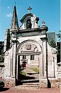 The churchyard entrance
 -
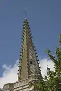 The church spire
 -
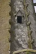 Architectural detail
 -
 Typical regional houses
 -
The church
This article is issued from Wikipedia. The text is available under Creative Commons Attribution-Share Alike 4.0 unless otherwise noted. Additional terms may apply for the media files.