Tilloy-lès-Hermaville
Tilloy-lès-Hermaville | |
|---|---|
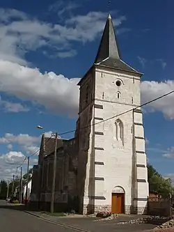 The church of Tilloy-lès-Hermaville | |
Location of Tilloy-lès-Hermaville | |
 Tilloy-lès-Hermaville  Tilloy-lès-Hermaville | |
| Coordinates: 50°19′40″N 2°33′29″E / 50.3278°N 2.5581°E / 50.3278; 2.5581 | |
| Country | France |
| Region | Hauts-de-France |
| Department | Pas-de-Calais |
| Arrondissement | Arras |
| Canton | Avesnes-le-Comte |
| Intercommunality | CC Campagnes de l'Artois |
| Government | |
| • Mayor (2020–2026) | David Duchateau[1] |
Area 1 | 2.87 km2 (1.11 sq mi) |
| Population (2022)[2] | 216 |
| • Density | 75/km2 (190/sq mi) |
| Time zone | UTC+01:00 (CET) |
| • Summer (DST) | UTC+02:00 (CEST) |
| INSEE/Postal code | 62816 /62690 |
| Elevation | 99–138 m (325–453 ft) (avg. 118 m or 387 ft) |
| 1 French Land Register data, which excludes lakes, ponds, glaciers > 1 km2 (0.386 sq mi or 247 acres) and river estuaries. | |
Tilloy-lès-Hermaville is a commune in the Pas-de-Calais department in the Hauts-de-France region of France[3] 9 miles (14 km) west of Arras.
Population
| Year | Pop. | ±% p.a. |
|---|---|---|
| 1968 | 139 | — |
| 1975 | 137 | −0.21% |
| 1982 | 149 | +1.21% |
| 1990 | 186 | +2.81% |
| 1999 | 178 | −0.49% |
| 2007 | 211 | +2.15% |
| 2012 | 229 | +1.65% |
| 2017 | 223 | −0.53% |
| Source: INSEE[4] | ||
See also
References
- ^ "Répertoire national des élus: les maires". data.gouv.fr, Plateforme ouverte des données publiques françaises (in French). 9 August 2021.
- ^ "Populations de référence 2022" (in French). The National Institute of Statistics and Economic Studies. 19 December 2024.
- ^ INSEE commune file
- ^ Population en historique depuis 1968, INSEE
Wikimedia Commons has media related to Tilloy-lès-Hermaville.
-
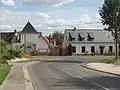 Crossroads
 -
 Town hall
 -
 Social hall
This article is issued from Wikipedia. The text is available under Creative Commons Attribution-Share Alike 4.0 unless otherwise noted. Additional terms may apply for the media files.