Tilloy-lès-Mofflaines
Tilloy-lès-Mofflaines | |
|---|---|
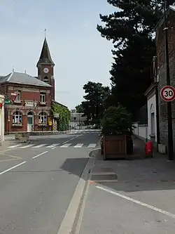 The centre of Tilloy-lès-Mofflaines | |
 Coat of arms | |
Location of Tilloy-lès-Mofflaines | |
 Tilloy-lès-Mofflaines  Tilloy-lès-Mofflaines | |
| Coordinates: 50°16′38″N 2°49′02″E / 50.2772°N 2.8172°E / 50.2772; 2.8172 | |
| Country | France |
| Region | Hauts-de-France |
| Department | Pas-de-Calais |
| Arrondissement | Arras |
| Canton | Arras-3 |
| Intercommunality | Arras |
| Government | |
| • Mayor (2020–2026) | Didier Michel[1] |
Area 1 | 7.69 km2 (2.97 sq mi) |
| Population (2022)[2] | 1,564 |
| • Density | 200/km2 (530/sq mi) |
| Time zone | UTC+01:00 (CET) |
| • Summer (DST) | UTC+02:00 (CEST) |
| INSEE/Postal code | 62817 /62217 |
| Elevation | 54–102 m (177–335 ft) (avg. 84 m or 276 ft) |
| 1 French Land Register data, which excludes lakes, ponds, glaciers > 1 km2 (0.386 sq mi or 247 acres) and river estuaries. | |
Tilloy-lès-Mofflaines (French pronunciation: [tilwa lɛ mɔflɛn]) is a commune in the Pas-de-Calais department in the Hauts-de-France region of France[3] southeast of Arras.
Population
| Year | Pop. | ±% p.a. |
|---|---|---|
| 1968 | 773 | — |
| 1975 | 744 | −0.54% |
| 1982 | 806 | +1.15% |
| 1990 | 1,309 | +6.25% |
| 1999 | 1,329 | +0.17% |
| 2007 | 1,380 | +0.47% |
| 2012 | 1,424 | +0.63% |
| 2017 | 1,434 | +0.14% |
| Source: INSEE[4] | ||
See also
References
- ^ "Répertoire national des élus: les maires". data.gouv.fr, Plateforme ouverte des données publiques françaises (in French). 2 December 2020.
- ^ "Populations de référence 2022" (in French). The National Institute of Statistics and Economic Studies. 19 December 2024.
- ^ INSEE commune file
- ^ Population en historique depuis 1968, INSEE
External links
Wikimedia Commons has media related to Tilloy-lès-Mofflaines.
| Authority control databases |
|---|
This article is issued from Wikipedia. The text is available under Creative Commons Attribution-Share Alike 4.0 unless otherwise noted. Additional terms may apply for the media files.