Nempont-Saint-Firmin
Nempont-Saint-Firmin | |
|---|---|
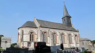 The church of Nempont-Saint-Firmin | |
 Coat of arms | |
Location of Nempont-Saint-Firmin | |
 Nempont-Saint-Firmin  Nempont-Saint-Firmin | |
| Coordinates: 50°21′20″N 1°44′01″E / 50.3556°N 1.7336°E | |
| Country | France |
| Region | Hauts-de-France |
| Department | Pas-de-Calais |
| Arrondissement | Montreuil |
| Canton | Berck |
| Intercommunality | CA Deux Baies en Montreuillois |
| Government | |
| • Mayor (2020–2026) | Thierry Poillet[1] |
Area 1 | 4.48 km2 (1.73 sq mi) |
| Population (2022)[2] | 200 |
| • Density | 45/km2 (120/sq mi) |
| Time zone | UTC+01:00 (CET) |
| • Summer (DST) | UTC+02:00 (CEST) |
| INSEE/Postal code | 62602 /62180 |
| Elevation | 2–53 m (6.6–173.9 ft) (avg. 25 m or 82 ft) |
| 1 French Land Register data, which excludes lakes, ponds, glaciers > 1 km2 (0.386 sq mi or 247 acres) and river estuaries. | |
Nempont-Saint-Firmin (French pronunciation: [nɑ̃pɔ̃ sɛ̃ fiʁmɛ̃]) is a commune in the Pas-de-Calais department in the Hauts-de-France region of France[3] in the valley of the Authie river, the border with the department of the Somme, some 8 miles (13 km) south of Montreuil-sur-Mer.
Population
The inhabitants of the town of Nempont-Saint-Firmin are called Nempontois, Nempontoises in French.[4]
| Year | Pop. | ±% p.a. |
|---|---|---|
| 1968 | 156 | — |
| 1975 | 158 | +0.18% |
| 1982 | 163 | +0.45% |
| 1990 | 160 | −0.23% |
| 1999 | 166 | +0.41% |
| 2007 | 199 | +2.29% |
| 2012 | 169 | −3.22% |
| 2017 | 198 | +3.22% |
| Source: INSEE[5] | ||
See also
References
- ^ "Répertoire national des élus: les maires". data.gouv.fr, Plateforme ouverte des données publiques françaises (in French). 9 August 2021.
- ^ "Populations de référence 2022" (in French). The National Institute of Statistics and Economic Studies. 19 December 2024.
- ^ INSEE commune file
- ^ Pas-de-Calais, habitants.fr
- ^ Population en historique depuis 1968, INSEE
Wikimedia Commons has media related to Nempont-Saint-Firmin.