Quiéry-la-Motte
Quiéry-la-Motte | |
|---|---|
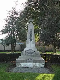 The monument to the dead of Quiéry-la-motte | |
 Coat of arms | |
Location of Quiéry-la-Motte | |
 Quiéry-la-Motte  Quiéry-la-Motte | |
| Coordinates: 50°21′59″N 2°58′44″E / 50.3664°N 2.9789°E | |
| Country | France |
| Region | Hauts-de-France |
| Department | Pas-de-Calais |
| Arrondissement | Arras |
| Canton | Brebières |
| Intercommunality | CC Osartis Marquion |
| Government | |
| • Mayor (2020–2026) | Frédéric Humez[1] |
Area 1 | 8.93 km2 (3.45 sq mi) |
| Population (2022)[2] | 711 |
| • Density | 80/km2 (210/sq mi) |
| Time zone | UTC+01:00 (CET) |
| • Summer (DST) | UTC+02:00 (CEST) |
| INSEE/Postal code | 62680 /62490 |
| Elevation | 26–64 m (85–210 ft) (avg. 32 m or 105 ft) |
| 1 French Land Register data, which excludes lakes, ponds, glaciers > 1 km2 (0.386 sq mi or 247 acres) and river estuaries. | |
Quiéry-la-Motte (French pronunciation: [kjeʁi la mɔt]; Picard: Chiéry-l'Motte) is a commune in the Pas-de-Calais department in the Hauts-de-France region of France.[3]
Geography
Quiéry-la-Motte is situated 12 miles (19 km) northeast of Arras, at the junction of the D39 and D48 roads. The A1 autoroute passes right by the commune.
Population
| Year | Pop. | ±% p.a. |
|---|---|---|
| 1968 | 568 | — |
| 1975 | 673 | +2.45% |
| 1982 | 701 | +0.58% |
| 1990 | 769 | +1.16% |
| 1999 | 775 | +0.09% |
| 2007 | 744 | −0.51% |
| 2012 | 736 | −0.22% |
| 2017 | 737 | +0.03% |
| Source: INSEE[4] | ||
Places of interest
See also
References
- ^ "Répertoire national des élus: les maires" (in French). data.gouv.fr, Plateforme ouverte des données publiques françaises. 13 September 2022.
- ^ "Populations de référence 2022" (in French). The National Institute of Statistics and Economic Studies. 19 December 2024.
- ^ INSEE commune file
- ^ Population en historique depuis 1968, INSEE
External links
Wikimedia Commons has media related to Quiéry-la-Motte.
- Official website of the commune (in French)