Ayguetinte
Ayguetinte | |
|---|---|
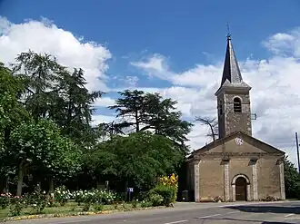 The church in Ayguetinte | |
Location of Ayguetinte | |
 Ayguetinte  Ayguetinte | |
| Coordinates: 43°50′06″N 0°25′41″E / 43.835°N 0.4281°E | |
| Country | France |
| Region | Occitania |
| Department | Gers |
| Arrondissement | Auch |
| Canton | Baïse-Armagnac |
| Intercommunality | CA Grand Auch Cœur Gascogne |
| Government | |
| • Mayor (2020–2026) | Francis Ballérini[1] |
Area 1 | 6.31 km2 (2.44 sq mi) |
| Population (2022)[2] | 157 |
| • Density | 25/km2 (64/sq mi) |
| Time zone | UTC+01:00 (CET) |
| • Summer (DST) | UTC+02:00 (CEST) |
| INSEE/Postal code | 32024 /32410 |
| Elevation | 96–203 m (315–666 ft) (avg. 113 m or 371 ft) |
| 1 French Land Register data, which excludes lakes, ponds, glaciers > 1 km2 (0.386 sq mi or 247 acres) and river estuaries. | |
Ayguetinte (French pronunciation: [ɛjɡətɛ̃t]; Aigatinta (colored water) in Occitan language) is a commune in the Gers department in southwestern France.
Geography

Population
| Year | Pop. | ±% |
|---|---|---|
| 1962 | 222 | — |
| 1968 | 199 | −10.4% |
| 1975 | 173 | −13.1% |
| 1982 | 172 | −0.6% |
| 1990 | 162 | −5.8% |
| 1999 | 152 | −6.2% |
| 2008 | 180 | +18.4% |
| 2014 | 165 | −8.3% |
See also
References
- [1] Archived 13 June 2020 at the Wayback Machine
- ^ "Répertoire national des élus: les maires" (in French). data.gouv.fr, Plateforme ouverte des données publiques françaises. 13 September 2022.
- ^ "Populations de référence 2022" (in French). The National Institute of Statistics and Economic Studies. 19 December 2024.
Wikimedia Commons has media related to Ayguetinte.