Gimbrède
Gimbrède | |
|---|---|
Location of Gimbrède | |
 Gimbrède  Gimbrède | |
| Coordinates: 44°02′27″N 0°43′10″E / 44.0408°N 0.7194°E | |
| Country | France |
| Region | Occitania |
| Department | Gers |
| Arrondissement | Condom |
| Canton | Lectoure-Lomagne |
| Government | |
| • Mayor (2020–2026) | Florence Chebassier[1] |
Area 1 | 24.98 km2 (9.64 sq mi) |
| Population (2022)[2] | 285 |
| • Density | 11/km2 (30/sq mi) |
| Time zone | UTC+01:00 (CET) |
| • Summer (DST) | UTC+02:00 (CEST) |
| INSEE/Postal code | 32146 /32340 |
| Elevation | 72–221 m (236–725 ft) (avg. 110 m or 360 ft) |
| 1 French Land Register data, which excludes lakes, ponds, glaciers > 1 km2 (0.386 sq mi or 247 acres) and river estuaries. | |
Gimbrède (French pronunciation: [ʒɛ̃bʁɛd]) is a commune in the Gers department in southwestern France.
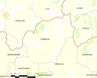
Geography
The river Auroue forms all of the commune's southeastern border, then flows north through its eastern part.
Population
| Year | Pop. | ±% |
|---|---|---|
| 1962 | 408 | — |
| 1968 | 365 | −10.5% |
| 1975 | 315 | −13.7% |
| 1982 | 292 | −7.3% |
| 1990 | 285 | −2.4% |
| 1999 | 287 | +0.7% |
| 2008 | 326 | +13.6% |
See also
References
- ^ "Répertoire national des élus: les maires" (in French). data.gouv.fr, Plateforme ouverte des données publiques françaises. 13 September 2022.
- ^ "Populations de référence 2022" (in French). The National Institute of Statistics and Economic Studies. 19 December 2024.
Wikimedia Commons has media related to Gimbrède.