Callian, Gers
Callian | |
|---|---|
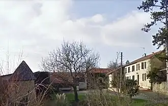 A view within Callian | |
Location of Callian | |
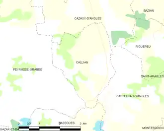
 Callian  Callian | |
| Coordinates: 43°37′47″N 0°16′42″E / 43.6297°N 0.2783°E | |
| Country | France |
| Region | Occitania |
| Department | Gers |
| Arrondissement | Auch |
| Canton | Fezensac |
| Intercommunality | Artagnan en Fézensac |
| Government | |
| • Mayor (2020–2026) | Philippe Ducès[1] |
Area 1 | 7.91 km2 (3.05 sq mi) |
| Population (2022)[2] | 53 |
| • Density | 6.7/km2 (17/sq mi) |
| Time zone | UTC+01:00 (CET) |
| • Summer (DST) | UTC+02:00 (CEST) |
| INSEE/Postal code | 32072 /32190 |
| Elevation | 137–227 m (449–745 ft) (avg. 235 m or 771 ft) |
| 1 French Land Register data, which excludes lakes, ponds, glaciers > 1 km2 (0.386 sq mi or 247 acres) and river estuaries. | |
Callian (French pronunciation: [kaljɑ̃]; Occitan: Calhan) is a commune in the Gers department in southwestern France.
Geography
Population
| Year | Pop. | ±% |
|---|---|---|
| 1962 | 91 | — |
| 1968 | 78 | −14.3% |
| 1975 | 67 | −14.1% |
| 1982 | 60 | −10.4% |
| 1990 | 59 | −1.7% |
| 1999 | 50 | −15.3% |
| 2008 | 51 | +2.0% |
See also
References
- ^ "Répertoire national des élus: les maires" (in French). data.gouv.fr, Plateforme ouverte des données publiques françaises. 13 September 2022.
- ^ "Populations de référence 2022" (in French). The National Institute of Statistics and Economic Studies. 19 December 2024.
Wikimedia Commons has media related to Callian (Gers).