Lourties-Monbrun
Lourties-Monbrun | |
|---|---|
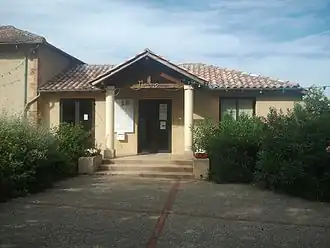 The town hall in Lourties-Monbrun | |
Location of Lourties-Monbrun | |
 Lourties-Monbrun  Lourties-Monbrun | |
| Coordinates: 43°27′24″N 0°32′26″E / 43.4567°N 0.5406°E | |
| Country | France |
| Region | Occitania |
| Department | Gers |
| Arrondissement | Mirande |
| Canton | Astarac-Gimone |
| Intercommunality | Val de Gers |
| Government | |
| • Mayor (2020–2026) | Karine Monfort[1] |
Area 1 | 9.5 km2 (3.7 sq mi) |
| Population (2022)[2] | 156 |
| • Density | 16/km2 (43/sq mi) |
| Time zone | UTC+01:00 (CET) |
| • Summer (DST) | UTC+02:00 (CEST) |
| INSEE/Postal code | 32216 /32140 |
| Elevation | 192–301 m (630–988 ft) (avg. 276 m or 906 ft) |
| 1 French Land Register data, which excludes lakes, ponds, glaciers > 1 km2 (0.386 sq mi or 247 acres) and river estuaries. | |
Lourties-Monbrun (French pronunciation: [luʁti mɔ̃bʁœ̃]; Occitan: Lortias e Montbrun) is a commune in the Gers department in southwestern France.
Geography

Population
| Year | Pop. | ±% |
|---|---|---|
| 1962 | 91 | — |
| 1968 | 61 | −33.0% |
| 1975 | 50 | −18.0% |
| 1982 | 93 | +86.0% |
| 1990 | 102 | +9.7% |
| 1999 | 108 | +5.9% |
| 2008 | 127 | +17.6% |
See also
References
- ^ "Répertoire national des élus: les maires" (in French). data.gouv.fr, Plateforme ouverte des données publiques françaises. 13 September 2022.
- ^ "Populations de référence 2022" (in French). The National Institute of Statistics and Economic Studies. 19 December 2024.
Wikimedia Commons has media related to Lourties-Monbrun.