Sirac, Gers
Sirac | |
|---|---|
.svg.png) Coat of arms | |
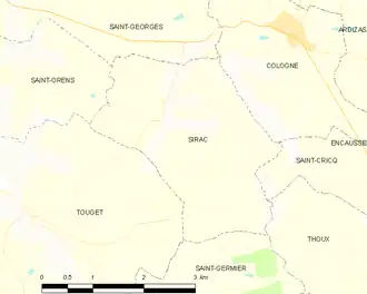
Location of Sirac | |
 Sirac  Sirac | |
| Coordinates: 43°42′41″N 0°57′05″E / 43.7114°N 0.9514°E | |
| Country | France |
| Region | Occitania |
| Department | Gers |
| Arrondissement | Condom |
| Canton | Gimone-Arrats |
| Government | |
| • Mayor (2020–2026) | Didier Williame[1] |
Area 1 | 8 km2 (3 sq mi) |
| Population (2022)[2] | 162 |
| • Density | 20/km2 (52/sq mi) |
| Time zone | UTC+01:00 (CET) |
| • Summer (DST) | UTC+02:00 (CEST) |
| INSEE/Postal code | 32435 /32430 |
| Elevation | 137–215 m (449–705 ft) (avg. 200 m or 660 ft) |
| 1 French Land Register data, which excludes lakes, ponds, glaciers > 1 km2 (0.386 sq mi or 247 acres) and river estuaries. | |
Sirac (French pronunciation: [siʁak]) is a commune in the Gers department in southwestern France.
Geography
Population
| Year | Pop. | ±% |
|---|---|---|
| 1962 | 205 | — |
| 1968 | 162 | −21.0% |
| 1975 | 134 | −17.3% |
| 1982 | 106 | −20.9% |
| 1990 | 98 | −7.5% |
| 1999 | 101 | +3.1% |
| 2008 | 123 | +21.8% |
See also
References
- ^ "Répertoire national des élus: les maires" (in French). data.gouv.fr, Plateforme ouverte des données publiques françaises. 13 September 2022.
- ^ "Populations de référence 2022" (in French). The National Institute of Statistics and Economic Studies. 19 December 2024.
Wikimedia Commons has media related to Sirac (Gers).