Le Houga
Le Houga | |
|---|---|
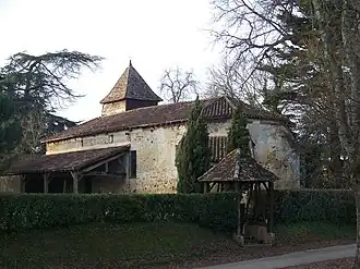 The church in Le Houga | |
.svg.png) Coat of arms | |
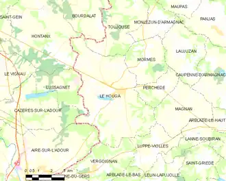
Location of Le Houga | |
 Le Houga  Le Houga | |
| Coordinates: 43°46′34″N 0°10′46″W / 43.7761°N 0.1794°W | |
| Country | France |
| Region | Occitania |
| Department | Gers |
| Arrondissement | Condom |
| Canton | Grand-Bas-Armagnac |
| Intercommunality | Bas-Armagnac |
| Government | |
| • Mayor (2020–2026) | Patricia Galabert[1] |
Area 1 | 31.51 km2 (12.17 sq mi) |
| Population (2022)[2] | 1,186 |
| • Density | 38/km2 (97/sq mi) |
| Time zone | UTC+01:00 (CET) |
| • Summer (DST) | UTC+02:00 (CEST) |
| INSEE/Postal code | 32155 /32460 |
| Elevation | 87–153 m (285–502 ft) (avg. 148 m or 486 ft) |
| 1 French Land Register data, which excludes lakes, ponds, glaciers > 1 km2 (0.386 sq mi or 247 acres) and river estuaries. | |
Le Houga (French pronunciation: [lə uɡa]; Occitan: Lo Haugar) is a commune in the Gers department in southwestern France.
Geography
Population
| Year | Pop. | ±% |
|---|---|---|
| 1962 | 1,164 | — |
| 1968 | 1,182 | +1.5% |
| 1975 | 1,124 | −4.9% |
| 1982 | 1,173 | +4.4% |
| 1990 | 1,166 | −0.6% |
| 1999 | 1,101 | −5.6% |
| 2008 | 1,141 | +3.6% |
See also
References
- ^ "Répertoire national des élus: les maires" (in French). data.gouv.fr, Plateforme ouverte des données publiques françaises. 13 September 2022.
- ^ "Populations de référence 2022" (in French). The National Institute of Statistics and Economic Studies. 19 December 2024.
Wikimedia Commons has media related to Le Houga.