Brugnens
Brugnens | |
|---|---|
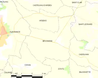
Location of Brugnens | |
 Brugnens  Brugnens | |
| Coordinates: 43°50′28″N 0°43′48″E / 43.8411°N 0.73°E | |
| Country | France |
| Region | Occitania |
| Department | Gers |
| Arrondissement | Condom |
| Canton | Fleurance-Lomagne |
| Intercommunality | Lomagne Gersoise |
| Government | |
| • Mayor (2020–2026) | Jean-Jacques Sangalli[1] |
Area 1 | 13.45 km2 (5.19 sq mi) |
| Population (2022)[2] | 255 |
| • Density | 19/km2 (49/sq mi) |
| Time zone | UTC+01:00 (CET) |
| • Summer (DST) | UTC+02:00 (CEST) |
| INSEE/Postal code | 32066 /32500 |
| Elevation | 97–200 m (318–656 ft) (avg. 192 m or 630 ft) |
| 1 French Land Register data, which excludes lakes, ponds, glaciers > 1 km2 (0.386 sq mi or 247 acres) and river estuaries. | |
Brugnens is a commune in the Gers department in southwestern France.
Geography
The river Auroue forms all of the commune's eastern border.
Population
| Year | Pop. | ±% |
|---|---|---|
| 1962 | 273 | — |
| 1968 | 251 | −8.1% |
| 1975 | 221 | −12.0% |
| 1982 | 231 | +4.5% |
| 1990 | 244 | +5.6% |
| 1999 | 250 | +2.5% |
| 2008 | 257 | +2.8% |
See also
References
- ^ "Répertoire national des élus: les maires". data.gouv.fr, Plateforme ouverte des données publiques françaises (in French). 9 August 2021.
- ^ "Populations de référence 2022" (in French). The National Institute of Statistics and Economic Studies. 19 December 2024.
Wikimedia Commons has media related to Brugnens.