Verlus
Verlus | |
|---|---|
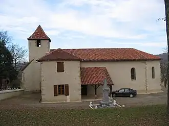 The church in Verlus | |
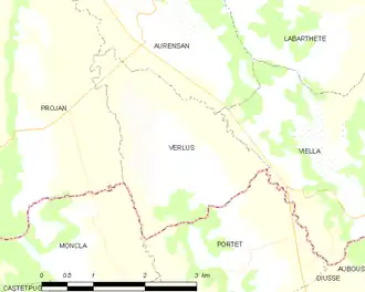
Location of Verlus | |
 Verlus  Verlus | |
| Coordinates: 43°36′11″N 0°11′43″W / 43.6031°N 0.1953°W | |
| Country | France |
| Region | Occitania |
| Department | Gers |
| Arrondissement | Mirande |
| Canton | Adour-Gersoise |
| Government | |
| • Mayor (2020–2026) | Jean Menvielle[1] |
Area 1 | 6.19 km2 (2.39 sq mi) |
| Population (2022)[2] | 122 |
| • Density | 20/km2 (51/sq mi) |
| Time zone | UTC+01:00 (CET) |
| • Summer (DST) | UTC+02:00 (CEST) |
| INSEE/Postal code | 32461 /32400 |
| Elevation | 98–236 m (322–774 ft) (avg. 210 m or 690 ft) |
| 1 French Land Register data, which excludes lakes, ponds, glaciers > 1 km2 (0.386 sq mi or 247 acres) and river estuaries. | |
Verlus is a commune in the Gers department in southwestern France.
Geography
Population
| Year | Pop. | ±% |
|---|---|---|
| 1962 | 120 | — |
| 1968 | 103 | −14.2% |
| 1975 | 80 | −22.3% |
| 1982 | 75 | −6.2% |
| 1990 | 90 | +20.0% |
| 1999 | 97 | +7.8% |
| 2008 | 99 | +2.1% |
See also
References
- ^ "Répertoire national des élus: les maires". data.gouv.fr, Plateforme ouverte des données publiques françaises (in French). 2 December 2020.
- ^ "Populations de référence 2022" (in French). The National Institute of Statistics and Economic Studies. 19 December 2024.
Wikimedia Commons has media related to Verlus.