Labarthète
Labarthète | |
|---|---|
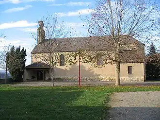 The church in Labarthète | |
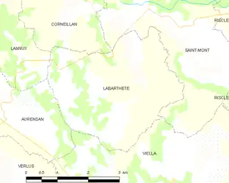
Location of Labarthète | |
 Labarthète  Labarthète | |
| Coordinates: 43°37′50″N 0°09′19″W / 43.6306°N 0.1553°W | |
| Country | France |
| Region | Occitania |
| Department | Gers |
| Arrondissement | Mirande |
| Canton | Adour-Gersoise |
| Government | |
| • Mayor (2020–2026) | Philippe Dufau[1] |
Area 1 | 11.09 km2 (4.28 sq mi) |
| Population (2022)[2] | 146 |
| • Density | 13/km2 (34/sq mi) |
| Time zone | UTC+01:00 (CET) |
| • Summer (DST) | UTC+02:00 (CEST) |
| INSEE/Postal code | 32170 /32400 |
| Elevation | 99–233 m (325–764 ft) (avg. 210 m or 690 ft) |
| 1 French Land Register data, which excludes lakes, ponds, glaciers > 1 km2 (0.386 sq mi or 247 acres) and river estuaries. | |
Labarthète (French pronunciation: [labaʁtɛt]; Occitan: La Barteta) is a commune in the Gers département in southwestern France.
Geography
Population
| Year | Pop. | ±% |
|---|---|---|
| 1962 | 198 | — |
| 1968 | 205 | +3.5% |
| 1975 | 151 | −26.3% |
| 1982 | 154 | +2.0% |
| 1990 | 150 | −2.6% |
| 1999 | 137 | −8.7% |
| 2005 | 142 | +3.6% |
| 2010 | 147 | +3.5% |
| 2013 | 143 | −2.7% |
See also
References
- ^ "Répertoire national des élus: les maires". data.gouv.fr, Plateforme ouverte des données publiques françaises (in French). 2 December 2020.
- ^ "Populations de référence 2022" (in French). The National Institute of Statistics and Economic Studies. 19 December 2024.
Wikimedia Commons has media related to Labarthète.