Labrihe
Labrihe | |
|---|---|
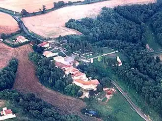 A general view of Labrihe | |
Location of Labrihe | |
 Labrihe  Labrihe | |
| Coordinates: 43°46′17″N 0°52′38″E / 43.7714°N 0.8772°E | |
| Country | France |
| Region | Occitania |
| Department | Gers |
| Arrondissement | Condom |
| Canton | Gimone-Arrats |
| Government | |
| • Mayor (2020–2026) | Christian Pontac[1] |
Area 1 | 9.44 km2 (3.64 sq mi) |
| Population (2022)[2] | 213 |
| • Density | 23/km2 (58/sq mi) |
| Time zone | UTC+01:00 (CET) |
| • Summer (DST) | UTC+02:00 (CEST) |
| INSEE/Postal code | 32173 /32120 |
| Elevation | 115–184 m (377–604 ft) (avg. 184 m or 604 ft) |
| 1 French Land Register data, which excludes lakes, ponds, glaciers > 1 km2 (0.386 sq mi or 247 acres) and river estuaries. | |
Labrihe is a commune in the Gers department in southwestern France.
Geography

Population
| Year | Pop. | ±% |
|---|---|---|
| 1962 | 181 | — |
| 1968 | 152 | −16.0% |
| 1975 | 142 | −6.6% |
| 1982 | 145 | +2.1% |
| 1990 | 136 | −6.2% |
| 1999 | 150 | +10.3% |
| 2008 | 204 | +36.0% |
See also
References
- ^ "Répertoire national des élus: les maires". data.gouv.fr, Plateforme ouverte des données publiques françaises (in French). 2 December 2020.
- ^ "Populations de référence 2022" (in French). The National Institute of Statistics and Economic Studies. 19 December 2024.
Wikimedia Commons has media related to Labrihe.