Monbrun
Monbrun | |
|---|---|
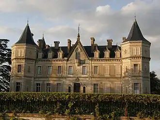 Chateau | |
.svg.png) Coat of arms | |
Location of Monbrun | |
 Monbrun  Monbrun | |
| Coordinates: 43°39′47″N 1°01′32″E / 43.6631°N 1.0256°E | |
| Country | France |
| Region | Occitania |
| Department | Gers |
| Arrondissement | Condom |
| Canton | Gimone-Arrats |
| Government | |
| • Mayor (2020–2026) | Jean-Jacques Sagansan[1] |
Area 1 | 10.8 km2 (4.2 sq mi) |
| Population (2022)[2] | 405 |
| • Density | 38/km2 (97/sq mi) |
| Time zone | UTC+01:00 (CET) |
| • Summer (DST) | UTC+02:00 (CEST) |
| INSEE/Postal code | 32262 /32600 |
| Elevation | 158–225 m (518–738 ft) (avg. 230 m or 750 ft) |
| 1 French Land Register data, which excludes lakes, ponds, glaciers > 1 km2 (0.386 sq mi or 247 acres) and river estuaries. | |
Monbrun (French pronunciation: [mɔ̃bʁœ̃]; Occitan: Montbrun) is a commune in the Gers department in southwestern France.
Geography

Population
| Year | Pop. | ±% |
|---|---|---|
| 1962 | 243 | — |
| 1968 | 238 | −2.1% |
| 1975 | 180 | −24.4% |
| 1982 | 198 | +10.0% |
| 1990 | 176 | −11.1% |
| 1999 | 214 | +21.6% |
| 2008 | 324 | +51.4% |
See also
References
- ^ "Répertoire national des élus: les maires". data.gouv.fr, Plateforme ouverte des données publiques françaises (in French). 9 August 2021.
- ^ "Populations de référence 2022" (in French). The National Institute of Statistics and Economic Studies. 19 December 2024.
Wikimedia Commons has media related to Monbrun.