Marguestau
Marguestau | |
|---|---|
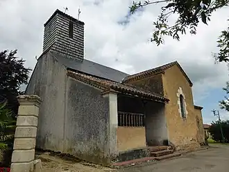 The church in Marguestau | |
Location of Marguestau | |
 Marguestau  Marguestau | |
| Coordinates: 43°53′09″N 0°02′25″W / 43.8858°N 0.0403°W | |
| Country | France |
| Region | Occitania |
| Department | Gers |
| Arrondissement | Condom |
| Canton | Grand-Bas-Armagnac |
| Intercommunality | Grand-Armagnac |
| Government | |
| • Mayor (2020–2026) | Anthony Ferreira[1] |
Area 1 | 3.21 km2 (1.24 sq mi) |
| Population (2022)[2] | 56 |
| • Density | 17/km2 (45/sq mi) |
| Time zone | UTC+01:00 (CET) |
| • Summer (DST) | UTC+02:00 (CEST) |
| INSEE/Postal code | 32236 /32150 |
| Elevation | 101–148 m (331–486 ft) (avg. 140 m or 460 ft) |
| 1 French Land Register data, which excludes lakes, ponds, glaciers > 1 km2 (0.386 sq mi or 247 acres) and river estuaries. | |
Marguestau (French pronunciation: [maʁɡɛsto]) is a commune in the Gers department in southwestern France.
Geography

Population
| Year | Pop. | ±% |
|---|---|---|
| 1962 | 88 | — |
| 1968 | 77 | −12.5% |
| 1975 | 77 | +0.0% |
| 1982 | 64 | −16.9% |
| 1990 | 66 | +3.1% |
| 1999 | 59 | −10.6% |
| 2008 | 62 | +5.1% |
See also
References
- ^ "Répertoire national des élus: les maires". data.gouv.fr, Plateforme ouverte des données publiques françaises (in French). 9 August 2021.
- ^ "Populations de référence 2022" (in French). The National Institute of Statistics and Economic Studies. 19 December 2024.
Wikimedia Commons has media related to Marguestau.